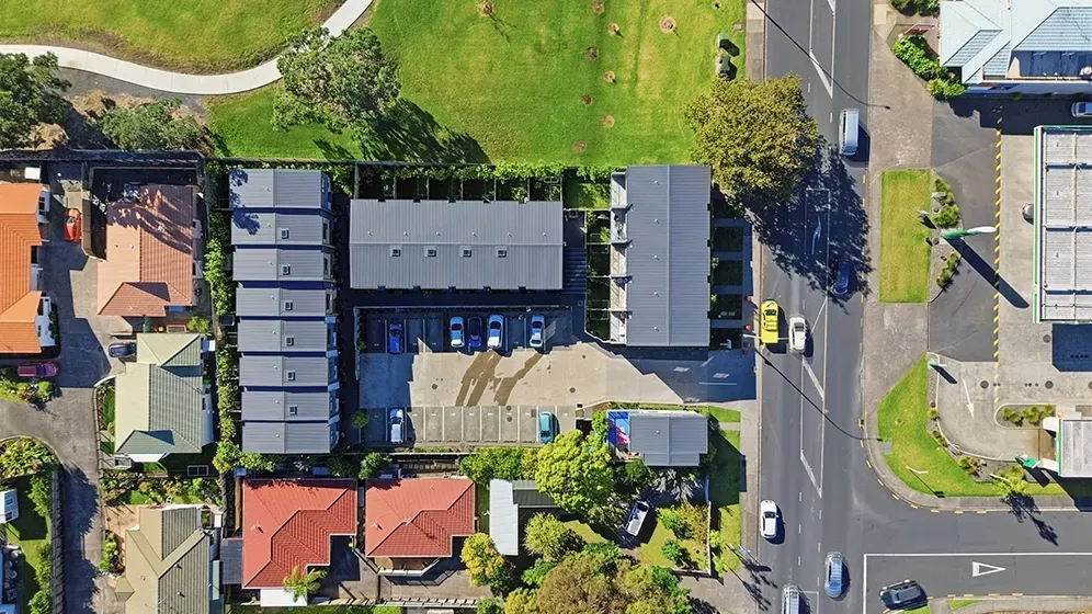
Aerial Photos of Your Own Property in NZ
If you want aerial photos of your own property, the simplest option is to hire a drone photographer who understands property work, safety rules and the kind of images you need.
Homeowners ask for aerial photos for different reasons. Some are preparing to sell. Some want a record of renovations, landscaping or a new build. Some need images for insurance, boundaries, lifestyle blocks, subdivision planning or family records.
The use case changes the shot list. A photo that works for a real estate listing may not be enough for a homeowner who wants to see boundary context, drainage, roof condition or land layout.
Can I take aerial photos of my own house with a drone?
Possibly, if you own a drone and can fly safely within New Zealand rules. But there are limits.
Drone flights need to follow CAA Part 101 rules, local airspace restrictions, privacy expectations, weather limits and safe operating distances. In Auckland, airspace can be more complicated than people expect because of airports, helipads, controlled zones, busy suburbs and coastal wind.
If you are flying for personal use on your own property, the job may be simple. If the images are for a property sale, public marketing, insurance, development or anything where quality and safety matter, hiring a professional is usually the better option.
For more detail, see the guide to CAA Part 101 drone rules.
Why homeowners get aerial property photos
Selling a property
Aerial photos help buyers understand the full property: the section, roofline, driveway, outdoor areas, views, neighbouring context and proximity to parks, beaches or reserves.
For private sellers, aerial can help a DIY listing look closer to an agency campaign. For agents, it rounds out the standard media package.
Renovations and before-after records
Aerial photos are useful before and after landscaping, pool installation, roofing, driveway work, extensions, decks and outdoor projects. They show progress in a way ground photos cannot.
Lifestyle blocks and larger sections
Large properties are hard to explain from the ground. Aerial photos show paddocks, sheds, fencing, driveways, tree lines, water access and the relationship between the home and land.
Boundary and site context
A drone photo is not a legal survey, but it can help a homeowner visually understand the property, surrounding land, access points and neighbouring context. If you need legal boundary certainty, use a surveyor.
Insurance and maintenance records
Some homeowners use aerial images to document roof condition, storm damage, drainage issues, trees, retaining walls or property changes over time. For anything claim-related, check what your insurer needs before booking the shoot.
What should you ask the drone photographer for?
Start with the reason you need the photos.
For a property sale, ask for:
front elevated hero image;
rear elevated image;
overhead property view;
boundary/context image if useful;
view or neighbourhood image with location pins;
driveway/access image for larger sites;
edited web-ready and high-resolution files.
For a lifestyle block, add:
wider land context;
paddocks, sheds and accessways;
water, bush, views or terrain;
multiple heights and angles.
For renovations or records, ask for repeatable angles. If you want before-and-after images later, the photographer should capture views that can be matched again from a similar position.
What affects the cost?
Aerial photo pricing depends on:
location and travel;
flight complexity;
number of final images;
whether ground photos are included;
whether video is needed;
editing and turnaround;
airspace checks or permission requirements;
whether the job is standalone or part of a listing package.
A standalone aerial-only job can cost more than adding aerial to a package because the photographer still needs to travel, check conditions, fly safely, edit the images and deliver files.
At Bash & Co, aerial is included in listing packages because it is part of how a property should be marketed, and standalone aerial photography is $180 GST-inclusive. Standalone aerial work is useful when you already have ground photos, need extra context, or want homeowner records rather than a full listing shoot.
When aerial photos are especially worth it
Aerial photos make the most sense when the ground view misses important information.
They are especially useful for:
large sections;
coastal or waterfront homes;
lifestyle blocks;
properties near parks, reserves or schools;
homes with views;
long driveways or unusual access;
new builds on bare sections;
properties where roof, land or outdoor layout matters.
For a smaller home on a simple suburban section, aerial can still help, but it should have a job. Do not add drone photos just because they look impressive. Add them when they explain something buyers or homeowners need to see.
What about privacy and neighbours?
A professional drone operator should avoid unnecessary intrusion. The goal is to photograph your property, not your neighbour's private outdoor areas.
In suburban areas, some neighbouring context may appear in wide aerial images. That is normal. But the shot list should focus on the subject property, and the flight should be handled safely and respectfully.
If you are concerned about neighbours, tell the photographer before the shoot. They can plan angles that show useful context without hovering over private spaces unnecessarily.
Booking aerial photos of your property
If you need aerial photos for an Auckland property, Bash & Co can capture standalone aerial images (from $180) or include drone coverage as part of a full listing media package. See aerial media services, read the guide to drone photography rules and costs, or compare packages and pricing.
Frequently Asked Questions
Can I get aerial photos of my house without selling it?
Yes. Homeowners can book aerial photos for renovations, records, insurance, lifestyle blocks, new builds, landscaping or personal use. The shot list should match the reason you need the images.
Are drone photos legal in NZ?
Drone photography is legal when flown within the relevant CAA rules, airspace restrictions, safety requirements and privacy expectations. Some locations need more planning than others.
Do aerial photos show legal boundaries?
Aerial photos can help show visual context, but they are not a legal boundary survey. If boundary accuracy matters, use a licensed surveyor and treat drone images as supporting visuals only.
How many aerial photos do I need?
For most homes, 6–8 useful edited aerial images are enough. Larger properties, lifestyle blocks and renovation records may need more angles.